02 Jun Epic Kansas Shelf Cloud
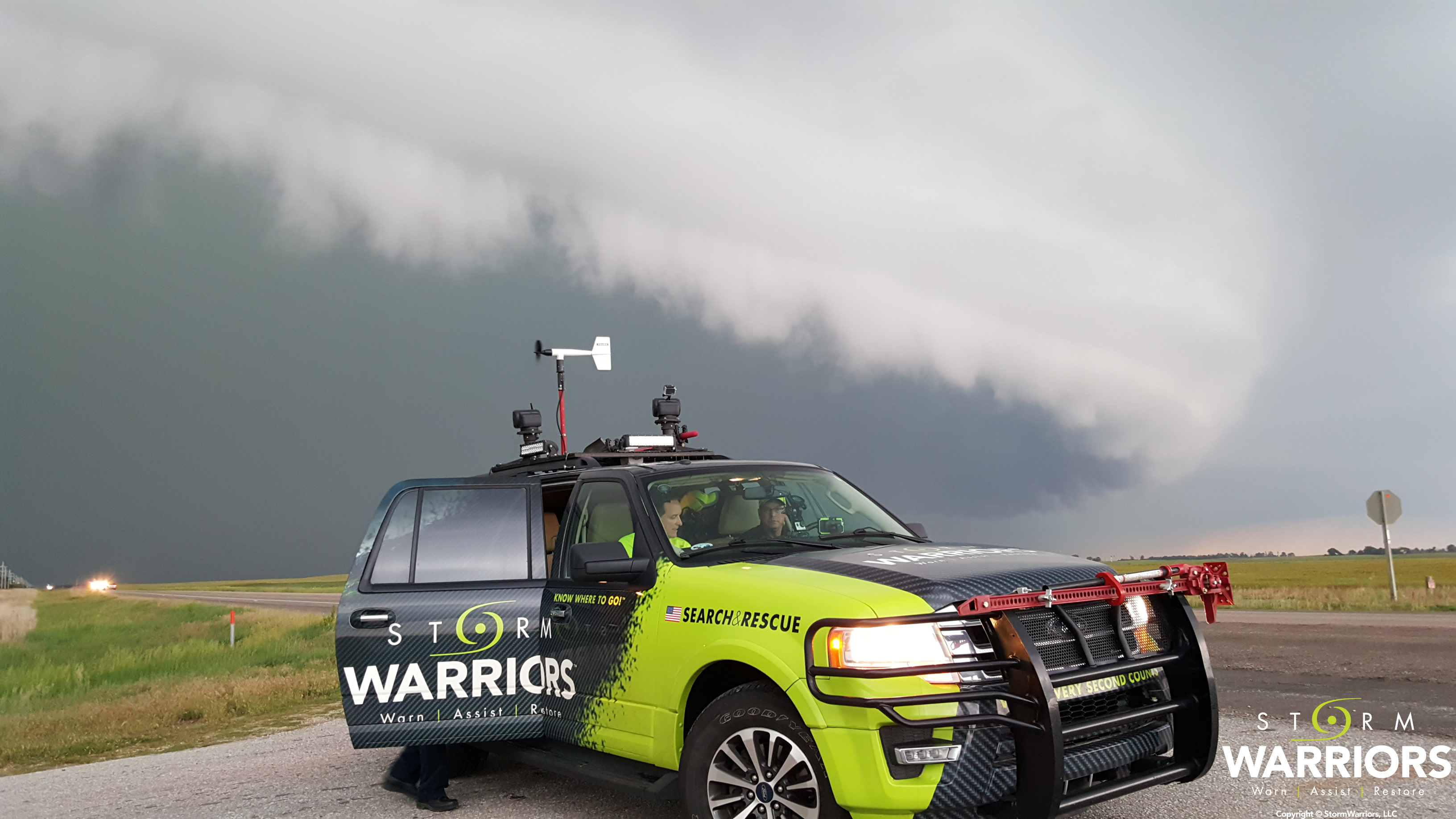
The Storm Warrior truck ahead of the shelf cloud. Pictured is Mike Casey (passenger seat) and Bill Ford (driver’s seat)
Thursday, May 26th was supposed to be a big tornado day. The SPC (Storm Prediction Center) had issued a MODERATE Risk for Severe Storms for a big chunk of central and west central Kansas and were expecting “all modes” of severe weather. This included mention of “strong tornadoes” possible. After what Kansas had experienced on the previous two days (14 tornadoes reported including some long track and violent tornadoes) this day was supposed to be bigger. The residents were no doubt on edge.
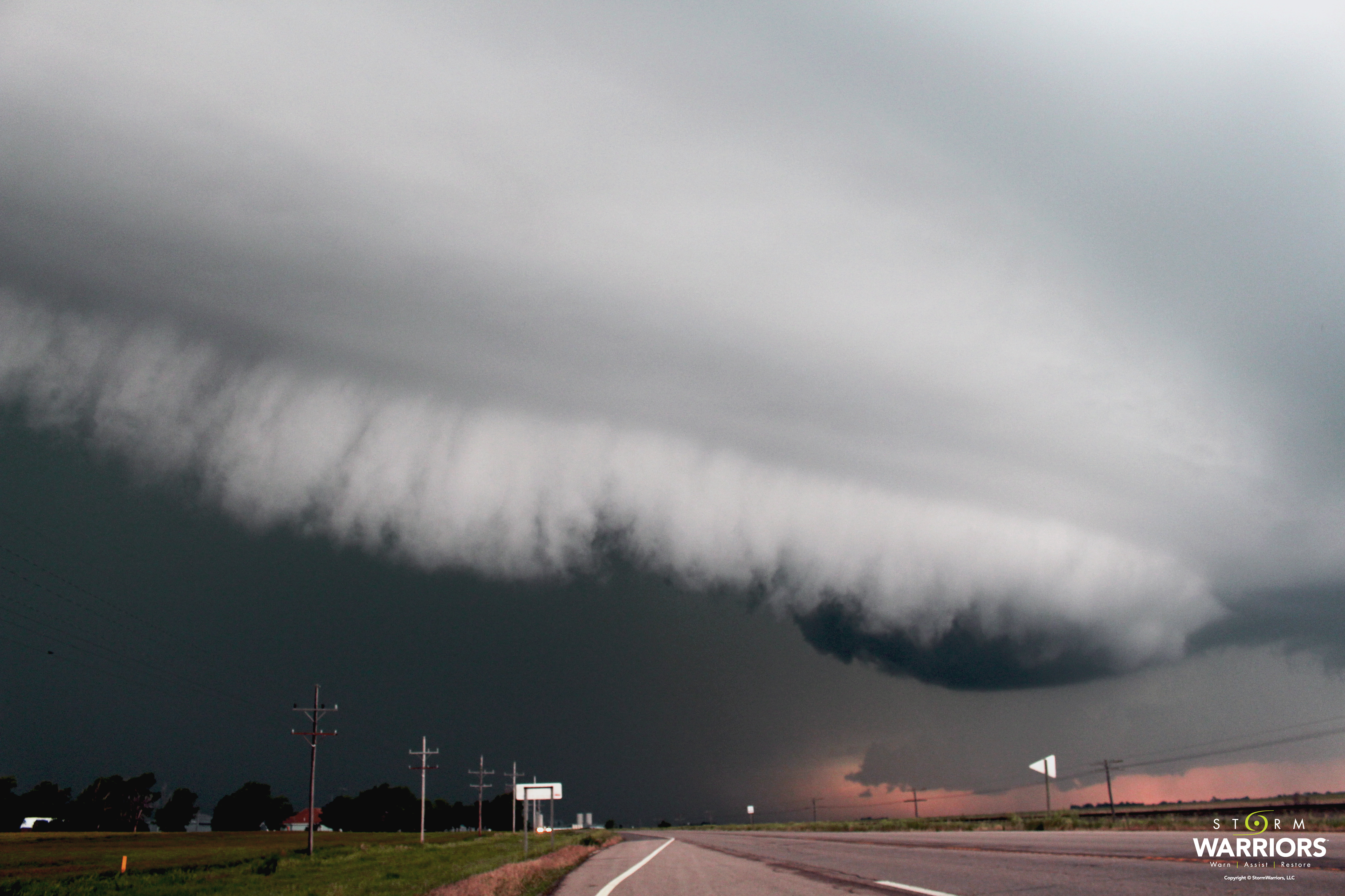
Fortunately the “messiness” of the storm coverage (lots of it earlier in the day) kept the severity of the storms down in the afternoon. No tornadoes were reported in the Moderate Risk area. This amazing “shelf cloud” was spotted just east of Dodge City, KS.
A shelf cloud is seen at the leading edge of an often severe thunderstorm and normally precedes intense winds. This storm had been tornado warned earlier but was only severe warned at the time and had winds greater than 65mph. You see these a lot in the prairies and over open waters as a storm comes ashore.
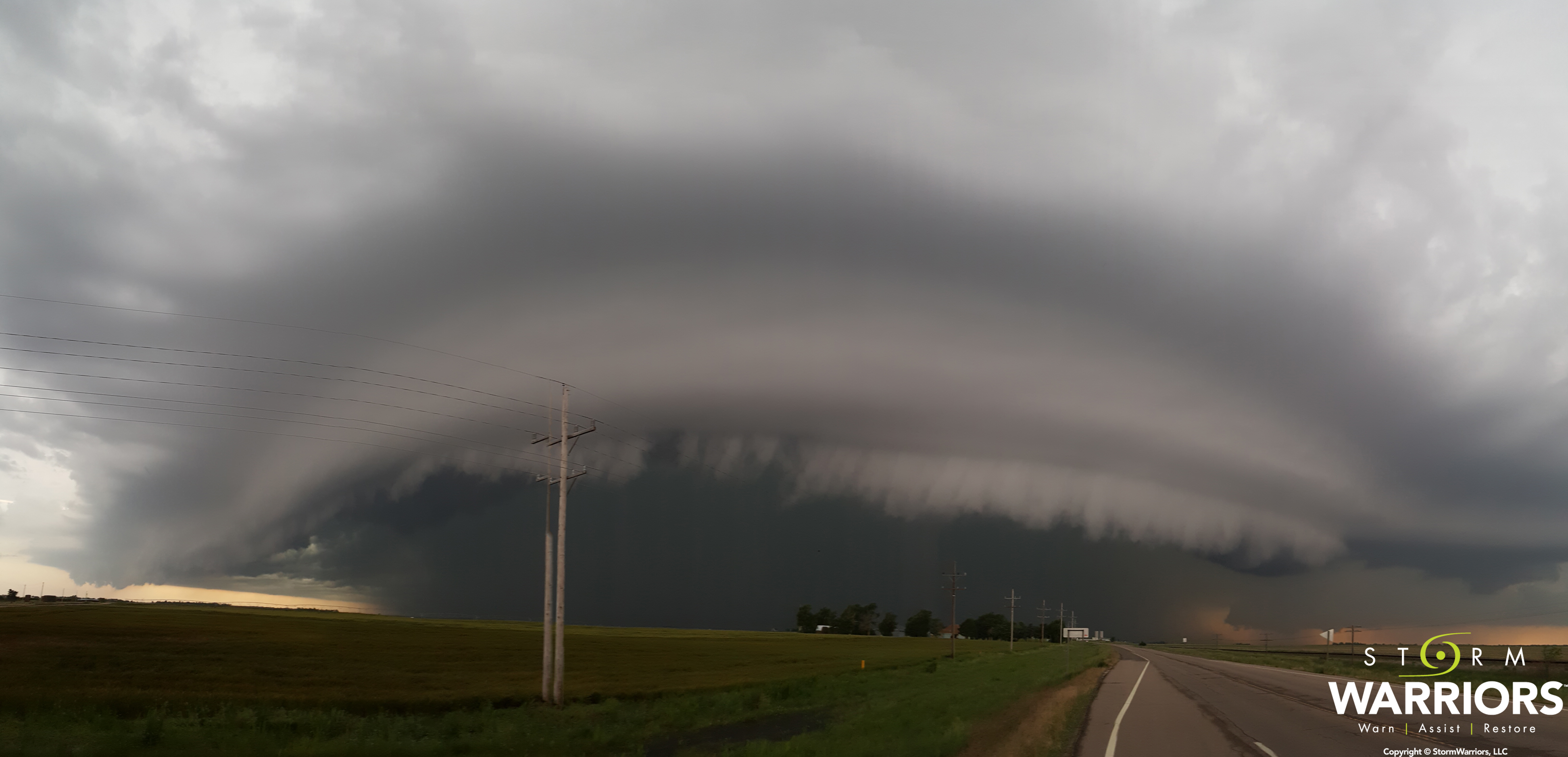
Panoramic shot of the Kansas shelf cloud
If you see this coming at you, you need to get inside your house immediately.
– Mike Prendergast